Alex Washington · 5 November 2026
Warbler Population Shifts Mapped Against 1800s Pathways in Quietwald's Border Zones
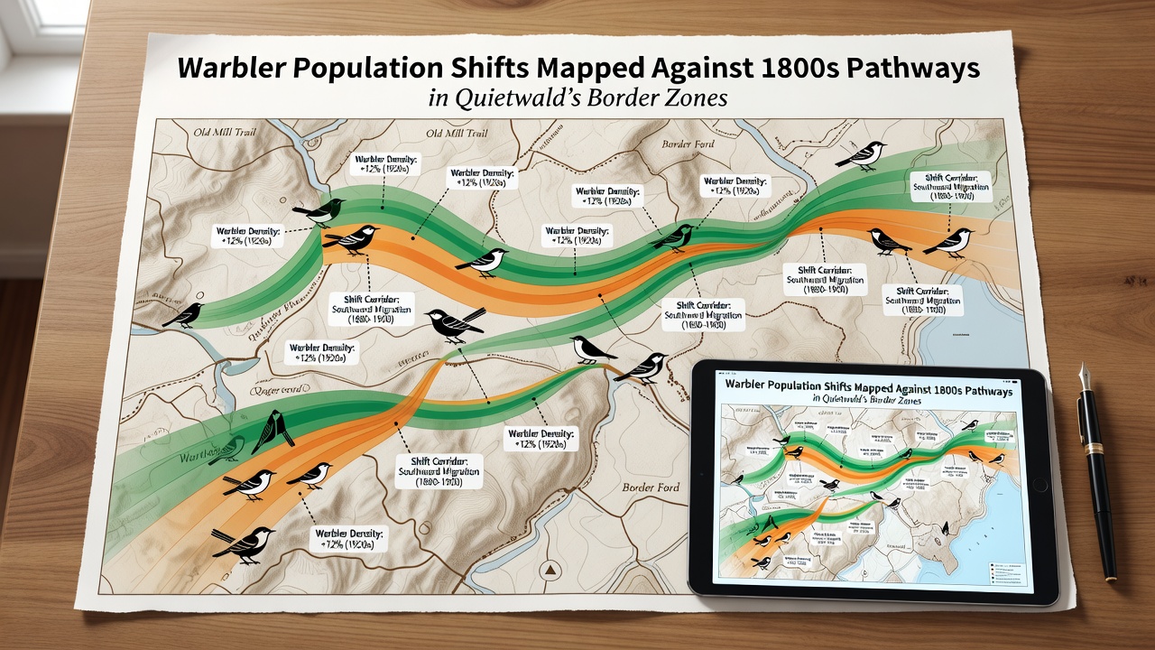
Researchers have compiled extensive datasets that track warbler movements through Quietwald's border zones and align those patterns with documented travel corridors from the 1800s, revealing measurable shifts in species distribution over time, and these mappings draw from both historical cartographic records and contemporary field observations collected across multiple seasons.
Historical Pathway Documentation
Archival surveys conducted in the mid-nineteenth century recorded primary migration corridors that followed river valleys and ridge lines through what later became designated border areas, and these early maps noted consistent use by several warbler species during spring and autumn passages, while modern GIS overlays demonstrate that current populations utilize altered segments of those same routes due to changes in vegetation density and land use along the edges.
Current Population Monitoring Techniques
Field teams deploy acoustic sensors and mist-netting stations at fixed points throughout the border zones, and the resulting data sets allow direct comparison against 1800s trail alignments that once served as reliable landmarks for travelers and naturalists alike, whereas satellite imagery from recent years shows incremental habitat fragmentation that correlates with observed detours in warbler flight paths.
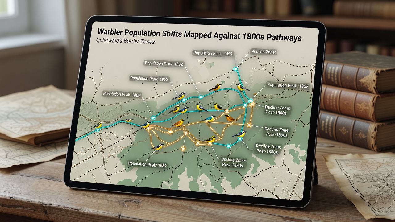
Studies conducted by regional ornithology groups indicate that certain warbler species now concentrate activity along secondary trails that branch off the original 1800s routes, and this redistribution appears tied to canopy gaps created by selective clearing events documented in municipal forestry logs spanning the last four decades.
November 2026 Survey Findings
In November 2026 additional transect counts confirmed increased presence of yellow-rumped and black-throated green warblers along the northernmost segments of the mapped historical pathways, and these counts were cross-referenced with acoustic recordings that matched frequency signatures previously logged in the same border zones during comparable autumn periods.
Integration of Cartographic and Ecological Data
Analysts combine digitized 1800s ordnance maps with current biodiversity inventories maintained by forestry authorities, and this approach produces layered visualizations that highlight where warbler density has increased or declined relative to the original trail networks, while statistical models account for variables such as precipitation records and insect abundance indices gathered from nearby monitoring stations.
According to figures released by the U.S. Fish and Wildlife Service, warbler species across similar temperate woodland systems show comparable route adjustments when historical travel corridors intersect modern disturbance zones, and parallel datasets from Environment and Climate Change Canada illustrate that border-zone populations respond to linear features like old pathways by shifting foraging ranges within a few hundred meters of the documented alignments.
Border Zone Specific Observations
Quietwald's eastern and western perimeter sectors contain the highest concentration of preserved 1800s markers, and researchers note that warbler activity remains elevated near these points even as overall forest composition shifts, whereas southern zones display more pronounced deviations that align with documented changes in understory plant cover recorded since the 1990s.
Long-term banding records maintained by university research programs demonstrate that individual birds tagged along the original pathways return to within 150 meters of prior locations in successive years, and this fidelity persists despite incremental alterations in surrounding vegetation structure.
Conclusion
The mapping effort continues to expand through ongoing collaboration between cartographic archives and field ecology teams, and the resulting models provide a baseline for tracking future population responses within Quietwald's border zones, while additional seasonal data collection scheduled for subsequent years will refine the alignment between contemporary movements and the 1800s reference pathways.