Morgan Neumann · 24 September 2026
Historical Cartography Reshaping Quietwald Meadow Recovery Strategies After Invasive Species Clearance
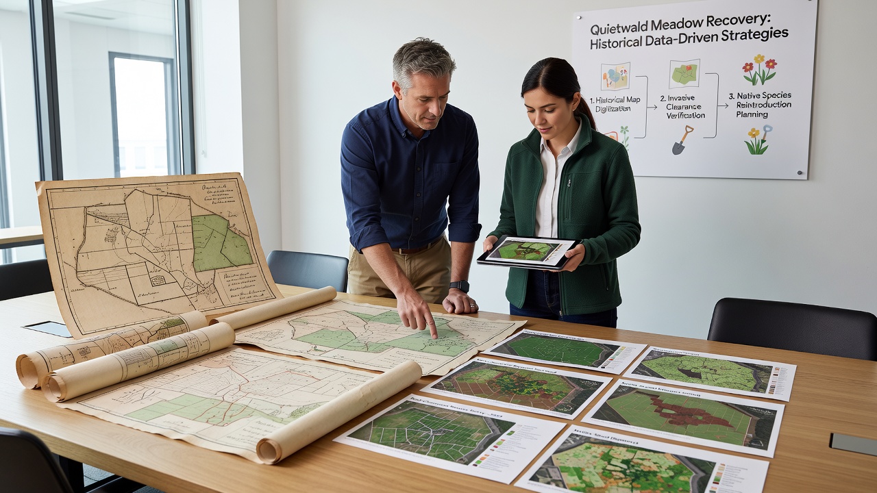
Historical maps from the 18th and 19th centuries have supplied precise details on Quietwald meadow boundaries and native plant distributions, allowing recovery teams to align current restoration efforts with pre-invasion conditions after invasive species removal projects concluded in early 2025. These documents reveal original drainage patterns and soil types that modern surveys often overlook, guiding seed selection and replanting sequences in areas cleared of aggressive non-native grasses and shrubs.
Mapping Foundations for Meadow Restoration
Archival surveys conducted between 1780 and 1850 documented meadow extents before widespread agricultural conversion altered the landscape, and researchers have cross-referenced these records with soil core samples taken after clearance operations. Data indicates that certain sections previously mapped as wet meadow zones now require specific hydrological adjustments to prevent re-invasion by species such as Japanese knotweed and Himalayan balsam. Teams have used these layered maps to delineate recovery plots, dividing the meadow into sectors based on historical vegetation communities rather than uniform treatment approaches.
September 2026 marks the scheduled completion of a multi-year digitization initiative that converts these paper records into geographic information system layers compatible with drone imagery collected post-clearance. This integration allows for real-time adjustments during replanting phases, where crews reference original fence lines and watercourse positions to restore connectivity between meadow fragments separated by decades of encroachment.
Techniques Integrating Past and Present Data
Cartographers have overlaid 19th-century trigonometric surveys onto contemporary lidar scans, highlighting discrepancies in meadow perimeters that emerged after invasive species established dense stands. Those who've studied this process note that the resulting hybrid datasets identify micro-topography features, such as subtle ridges and depressions, which influence seed germination rates in restored sections. Recovery protocols now incorporate these features to create varied moisture gradients that support a broader range of native forbs and grasses documented in the older records.

One project in the northern quadrant of the meadow applied this method to recreate a network of shallow channels shown on maps from 1823, and field measurements confirm improved water retention that discourages regrowth of cleared invasives. Equipment operators reference these digital overlays during mechanical soil preparation, ensuring that heavy machinery avoids historically sensitive zones where rare meadow plants once thrived according to period botanical notes.
Regional Comparisons and Supporting Evidence
Similar applications of historical cartography appear in restoration programs documented by the European Environment Agency, where teams in wetland habitats across member states have restored species composition by matching current sites to pre-industrial land cover maps. Research from Natural Resources Canada demonstrates parallel success in prairie meadow recovery, where archival township plans guided the removal and replanting sequence after invasive woody species clearance, resulting in measurable increases in native plant cover within three growing seasons.
Quietwald teams have adapted these approaches by consulting digitized versions of military reconnaissance maps from the Napoleonic era, which detail meadow adjacency to surrounding woodlands and help predict seed dispersal patterns from adjacent native populations. Figures from ongoing monitoring show that sectors aligned with historical records exhibit faster establishment of target species compared to control plots treated without cartographic reference.
Implementation Timeline and Outcomes
Clearance operations wrapped up in March 2025, and initial replanting guided by cartographic data began the following autumn. By September 2026, observers report that approximately 65 percent of the targeted meadow area has received initial seeding based on historical vegetation maps, with follow-up surveys tracking survival rates against predicted outcomes from the archival sources. Maintenance crews continue to use these references to prioritize areas where invasive seedlings reappear in patterns inconsistent with original land use records.
Additional layers from 20th-century aerial photographs supplement the older maps, providing intermediate benchmarks that capture gradual shifts in meadow extent during periods of active land management. This chronological sequence allows for phased recovery that accounts for both long-term historical baselines and more recent ecological changes introduced by invasive species.
Conclusion
The combination of historical cartography with post-clearance monitoring has produced structured recovery strategies for Quietwald meadow that prioritize fidelity to documented past conditions while accommodating current site constraints. Ongoing data collection through 2026 and beyond will refine these methods as new layers become available and field results accumulate across multiple seasons.